Winter Storm Watch for Torrance County

Images courtesy of NOAA/National Weather Service
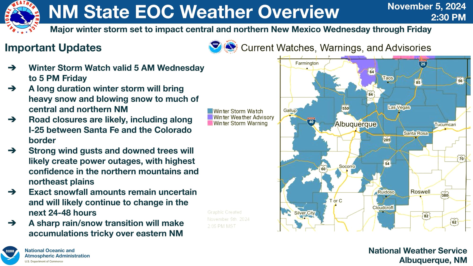
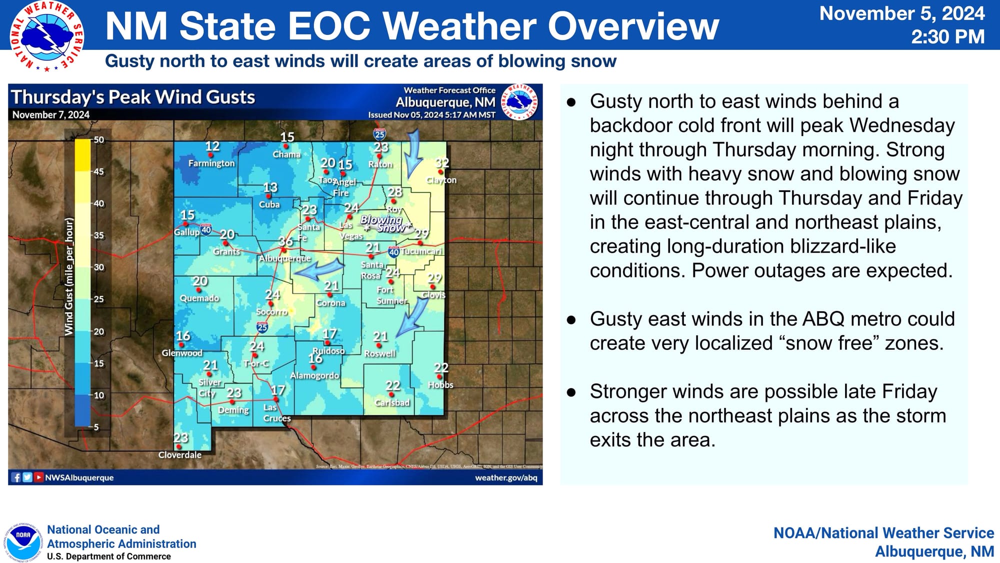
On Tuesday, November 5, 2024, the National Weather Service (NWS) issued a winter storm watch beginning 5:00 AM Wednesday, November 6, 2024, through 5:00 PM Friday, November 8, 2024. During this period, the NWS announced, it is expected that there will likely be road closures, strong wind gusts, and downed trees. As a result of the wind and downed trees, the NWS expects power outages, particularly between Taos and Quay Counties.
Images courtesy of NOAA/National Weather Service
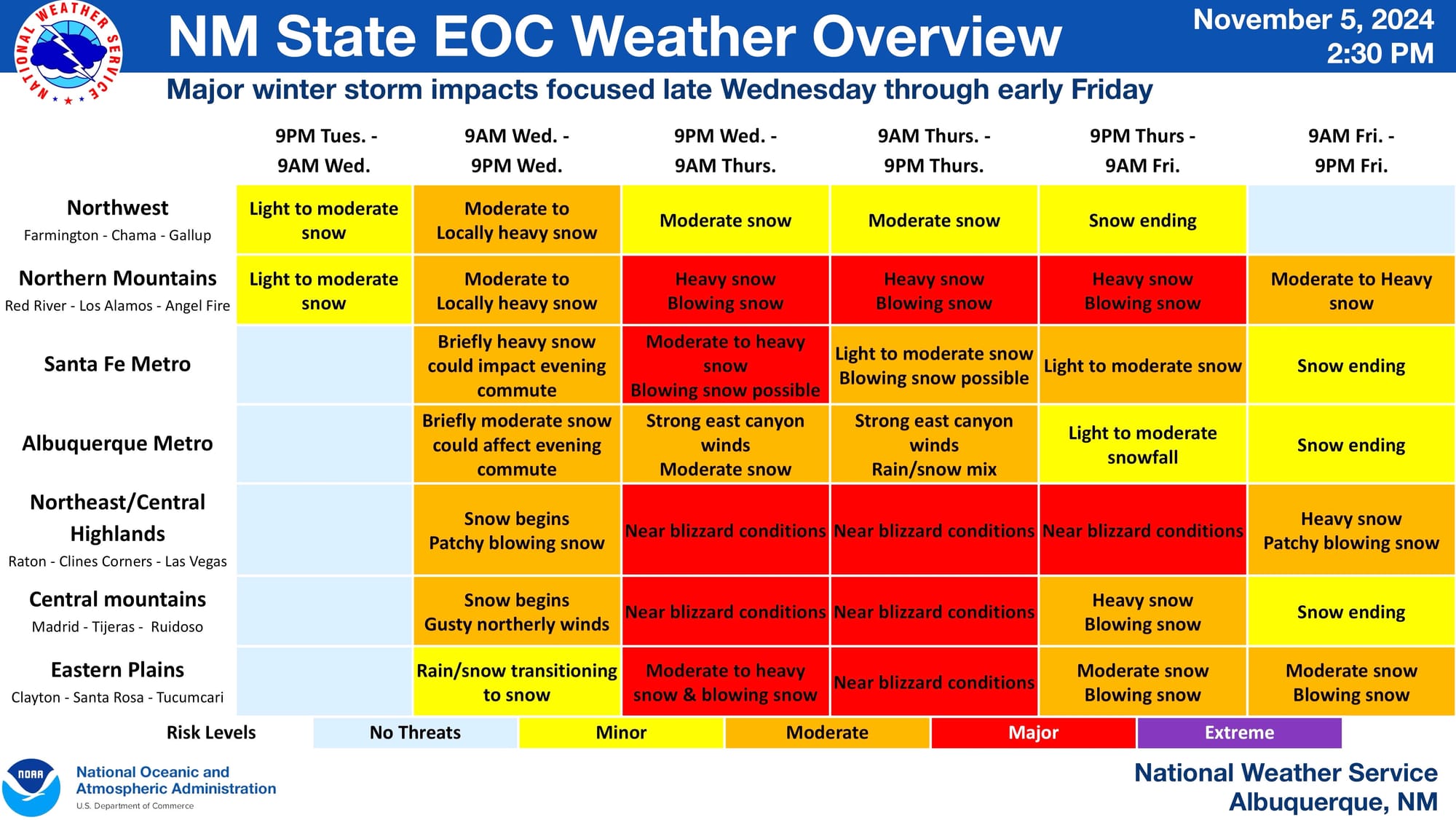
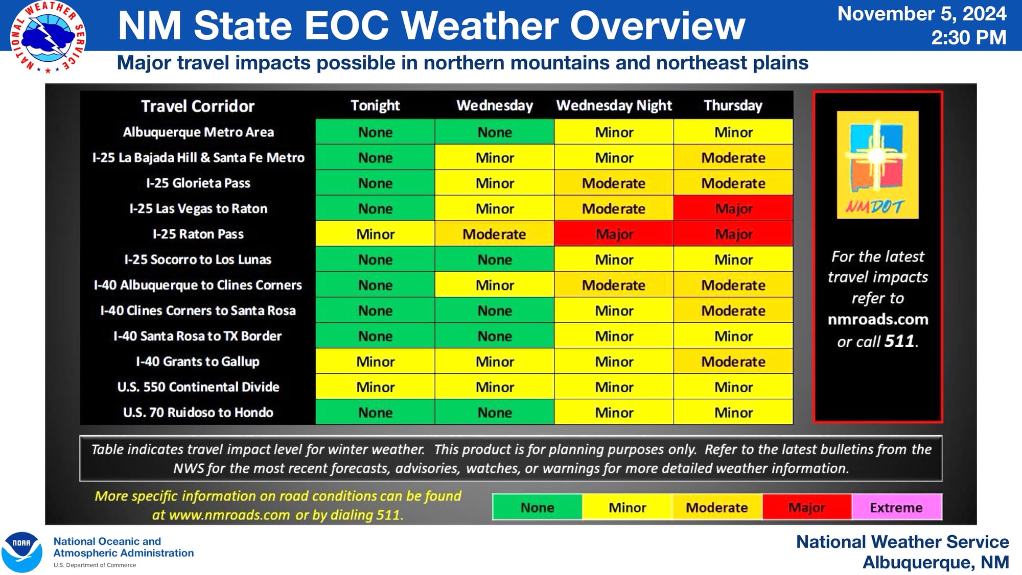
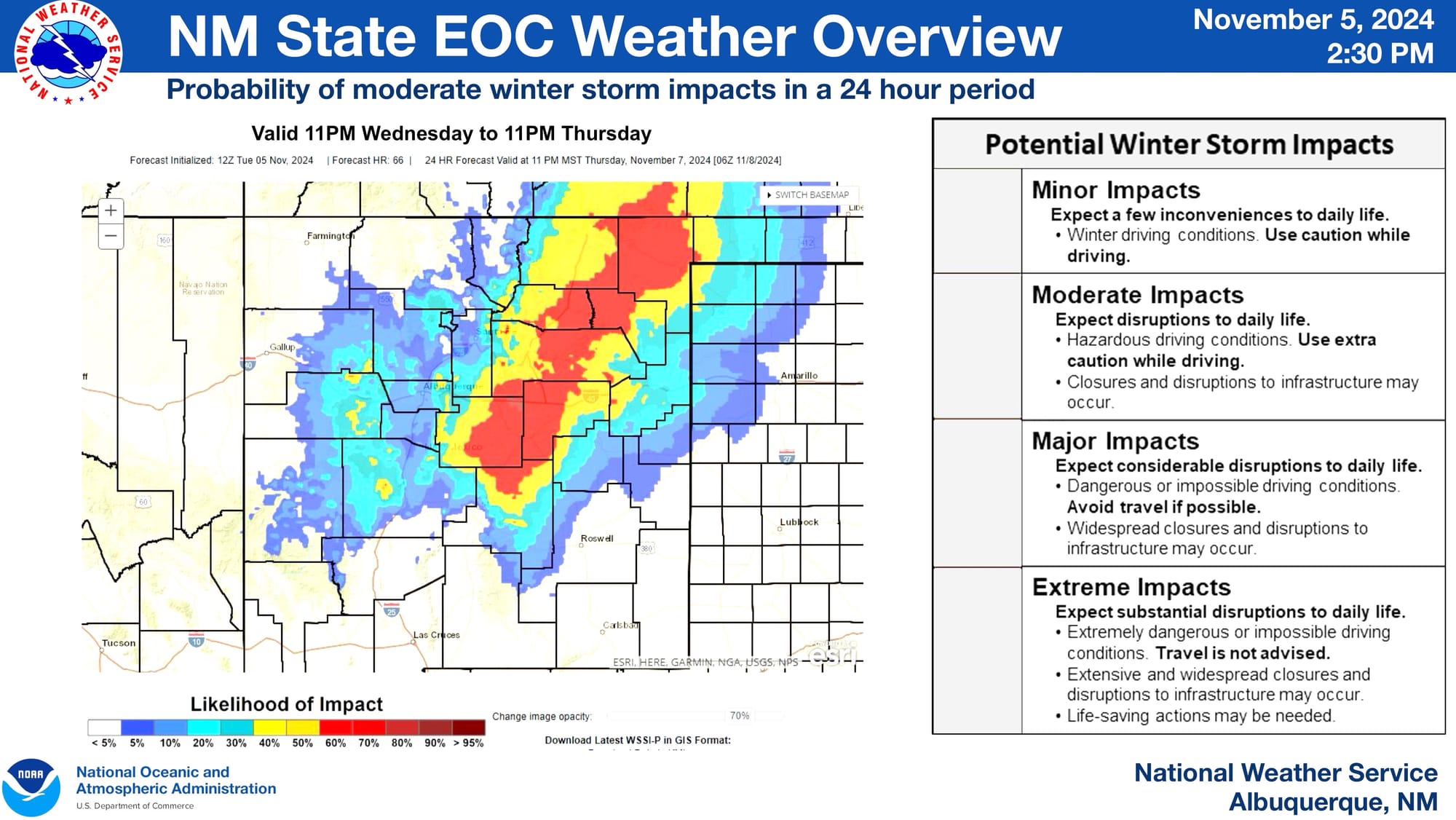
The NWS expects major winter storm impacts in Torrance County, with "near blizzard conditions" expected between Wednesday evening and Thursday evening. This is a smaller impact than what is expected for Colfax, Mora, and Santa Fe Counties. The NWS cautions that drivers should expect road closures on US-25, north to (and including) Raton Pass. The likelihood of closures on US-40 east to the Texas border is smaller.
Images courtesy of NOAA/National Weather Service
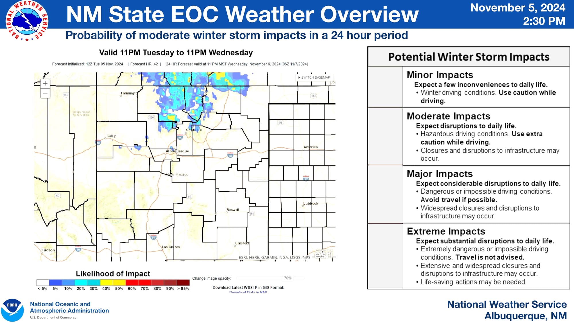
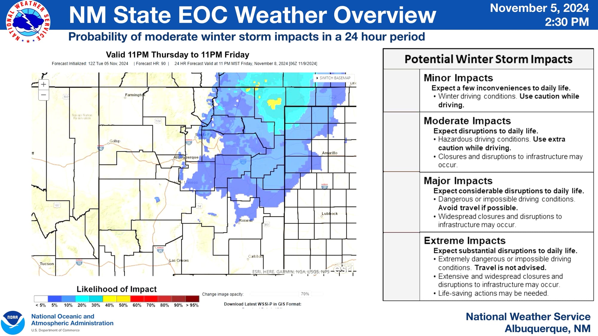
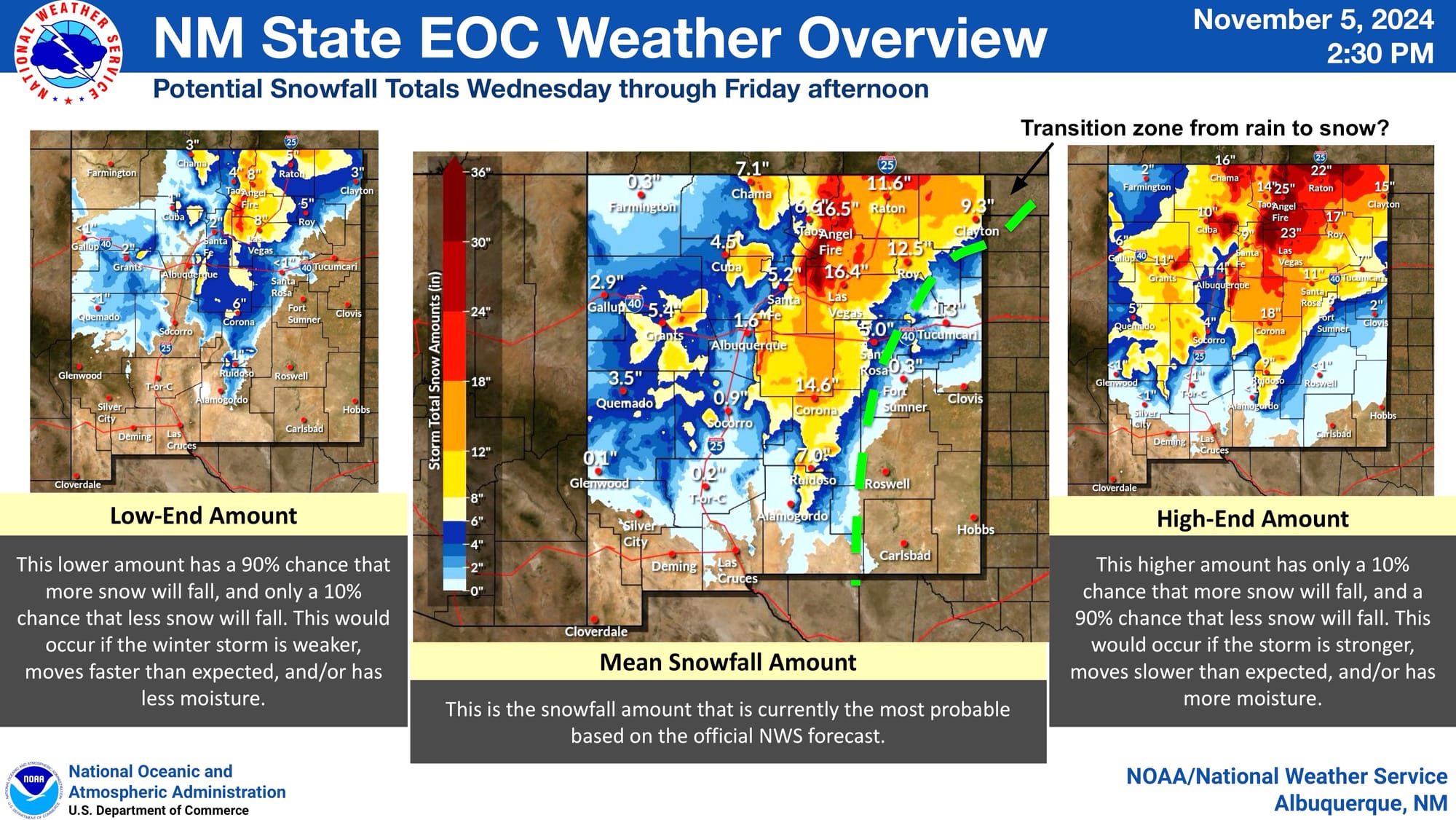
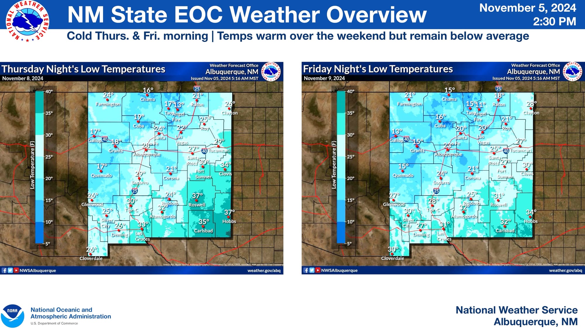
The NWS expects that this storm will have a moderate impact on Torrance County, primarily between Wednesday night and Thursday night. It warns residents to expect between 7 and 14 inches in the county, along with hazardous local road conditions and disruptions to local infrastructure.
Images courtesy of NOAA/National Weather Service